Open Map
Close Map
FATAL ERROR:
/embed_iframe/under-the-kramerkreuz.xml?no_hotspots=false&home_main_pano=false&portfolio_view=false&pro_embed=false - xml parsing failed!
error on line 5 at column 8: Opening and ending tag mismatch: link line 4 and head
INFO: krpano 1.22.3 (build 2024-12-20)
INFO: Desktop - WebGL2
INFO: Registered to: 360 Cities s.r.o. (old license)
CLOSE
LAYERS
HOTSPOTS
PANO
DEBUGKEYS
CLEARLOG
INPUT
N
Projections and Nav Modes
  • Normal View
  • Fisheye View
  • Architectural View
  • Stereographic View
  • Little Planet View
  • Panini View
Click and Drag / QTVR mode
分享这个全景图
For Non-Commercial Use Only
This panorama can be embedded into a non-commercial site at no charge. 查阅更多的
Do you agree to the Terms & Conditions?
For commercial use, 联系我们
Embed this Panorama
宽度高度
For Non-Commercial Use Only
For commercial use, 联系我们

This panorama is not currently enabled for commercial licensing. Click here to ask us to help you find a replacement. If this is your panorama, Click here This panorama is not currently enabled for commercial licensing.

LICENSE MODAL

0 Likes

Under The Kramerkreuz
Oberbayern

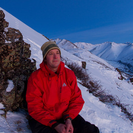
The Kramer is 1985m high with great views of Garmisch-Partenkirchen, Zugspitze, Alpspitze, Eibsee, the Wank. It is in the Ammergebirge range with views of the Wetterstein, Karwendel, and Estergebirge mountain ranges.

Copyright: Scott Harper
Type: Spherical
Resolution: 8948x4474
Taken: 25/06/2015
上传: 29/06/2015
Published: 05/07/2015
观看次数:

...


Tags: natur; outdoors; mountain; peak; alps; bavaria
More About Oberbayern

Oberbayern liegt im Südosten des Freistaats Bayern und grenzt im Süden und Osten an Österreich, im Nordosten an Niederbayern und die Oberpfalz, im Nordwesten an Mittelfranken und im Westen an Schwaben. Verwaltungssitz des Bezirks und gleichzeitig Regierungssitz des Regierungsbezirks ist München. Oberbayerns Grenzen haben sich im Laufe der Jahrhunderte mehrfach verändert. Insbesondere gibt es keinen spezifisch oberbayerischen Dialekt. Der Begriff „Oberbayern“ erscheint zum ersten Mal im Jahre 1255 bei der bayerischen Landesteilung. Die Ausdehnung war jedoch ursprünglich eine andere: Der Chiemgau und die Gegend von Bad Reichenhall gehörten damals zu Niederbayern.


It looks like you’re creating an order.
If you have any questions before you checkout, just let us know at info@360cities.net and we’ll get right back to you.